Cévennes
June 6th, 2003
Friday - le Mas de la Barque to le Collet-de-Dèze

|
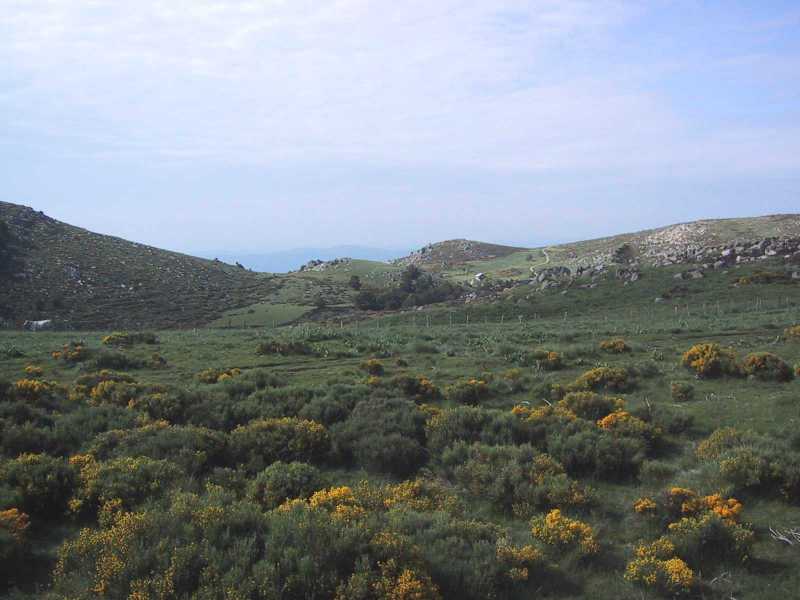
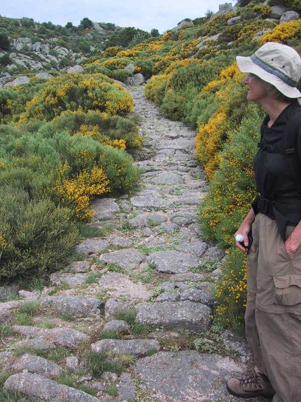
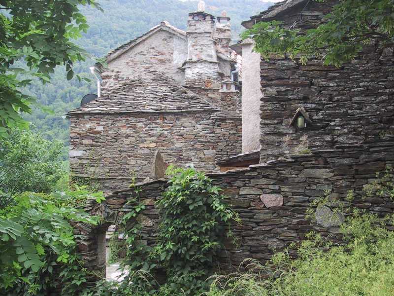
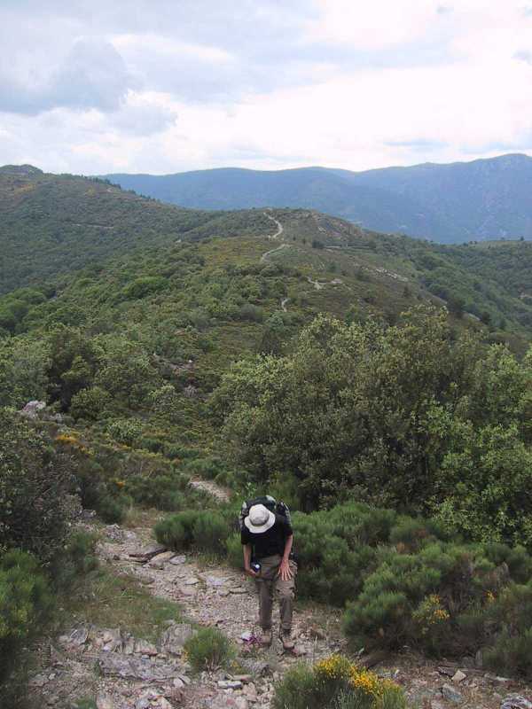
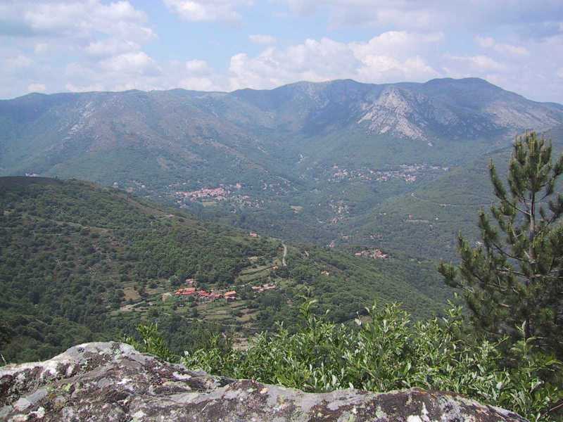
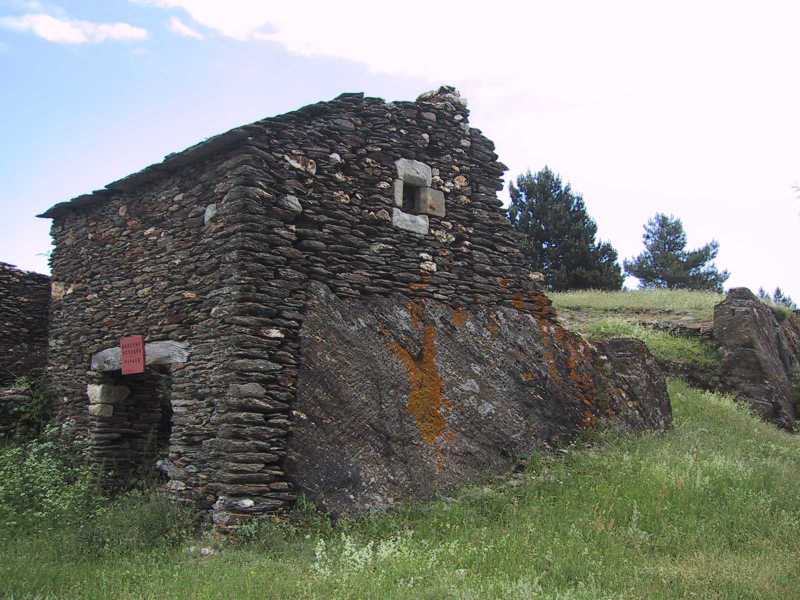
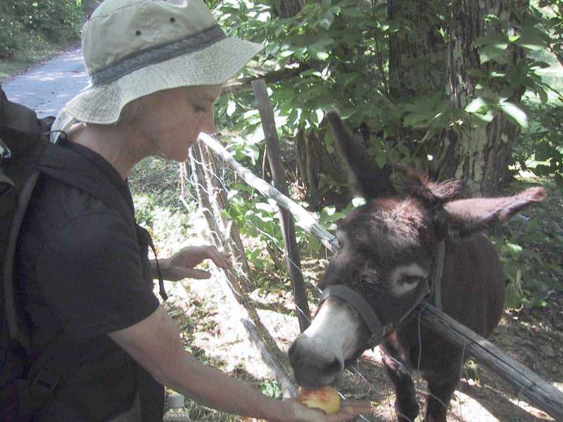
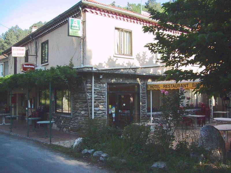
We were up before the cowboys and the sun was streaming in our little window. At breakfast we pored over three maps, and opted not to go to Arles but continue on the trail to le Collet-de-Dèze. Unfortunately the initial trail was a dotted line on the map which meant it was questionable. In bright sunshine we started out to the Rocher de Bayard and then took a woods road south. I tried to keep to the stream, but wound up in a bog and had to backtrack. On higher ground we hiked to a little brook which we could just cross on the rocks - I got a wet foot. We then walked up into a boggy field which was tough going and decided instead to bushwhack through a beech woods. We came out on a hillside of broom. After attempting the chest-high broom a little way I decided to stick to the forest and backtracked up the hill. Here Bon snagged her calf on the barbed wire of an old fence worrying us about the possibility of tetanus. We decided to continue to the Vialas and look for a pharmacy or doctor there. We followed the woods up the hill and came out in short broom which allowed us to cross to another forested area. This soon ended and we were again in broom but it was even shorter and interspersed with grazing trails. We now had a view of the valley and beyond to the hills we would cross. As we descended the terraced rocks and grass, we saw some white cows and we followed their fence to a road to the right. The first obstacle was a large horned bull. Rather than walk between him and the barbed wire fence we walked above him, descending to the road again when we were safely past. The road was easy going but wet with pollywogs in the puddles. Finally we crossed a little stream and came to some buildings. Here we picked up the GR de Pays Tour de la haute, a beautiful trail or draille that had been cobbled for taking sheep to the upper pastures. There was a spectacular view of the Rochers de Trenze a rocky slope to our left or east, as we descended first through grassy fields and then through a boulder field. After descending for a while, we hit a road which I unfortunately thought to be a lower road and which turned the wrong way. This passed a farm with horses to a meadow and then began to descend steeply. It was touch-and-go bushwhacking down very steep drops, sometimes dirt, sometimes rock. We passed over a stream to wooded terraces which with great difficulty always seemed to descend to our right. After a long spell of this we spotted a road below us only to find there was about a 15 foot drop to the road over a wall. I tried one place but Bon found a better way and I handed down my pack and joined her on the road. We took this in the wrong direction, over a bridge with a waterfall on one side and deep clear pool on the other. There we realized that we were heading out of town. We retraced our steps and passed several buildings including a place for vacances. We passed a mossy fountain and refilled our water bottles - a passing Frenchman with the same idea assured us it was wonderful water. We walked down into Vialas but found there was no Pharmacie or Medicin. We passed three people who were closing up a open-air market and one helped us with directions to Castagnois. We started in that direction but again worried about the tetanus returned to get more information about pharmacies, learning that the nearest pharmacy was in le Collet-de-Dèze. Thus assured, rather than go to Genolhac which would end our hiking, we headed to le Collet de Deze. We missed a turn on the path (it said voie sans issue or no exit) and instead we walked on by a Maison de Retraite, where some young people were having lunch outdoors. We soon realized we had lost the path and asked the young people for directions. They pointed us to the voie sans issue that we had abandoned. We passed through some buildings and then went high across le Luech river on a bridge. From there the trail climbed through many switchbacks and chestnut forests gradually rising to the little mountain village of Castagnois. The town was a series of homes along the road which were made of brown schist and were artful stone work. The road had high schist walls on both sides and we walked out of town and up the mountain to a dirt road that gradually ascended with views back across the river. We had soon climbed above the Maison de Retraite we had passed and gradually rose high above the town of Vialas with views over it to the mountains behind. The road continued to climb crossing a road over the mountains and rising through purple heather and yellow broom changing to a path along the ridge. Although the day had started as completely clear, an overcast front had overtaken us by the time we reached Vialas. It looked like rain as we continued to mount along the ridge trail. Finally I found a wonderful spot on an outcropping which overlooked the whole area. We took off our boots and had a late picnic with spectacular views to the north and east, butterflies flying over us and sheep bells tinkling below. After lunch the trail continued up and down on a rocky schist trail at the top of the ridge. We still had about 10 kilometers to go and it was past 3:30 p.m. We went at a fast pace and passed several old buildings as we joined the main road. We quickly left this and found ourselves climbing a steep switchback over a hill (passing a stone barn built into a large rock) and down the other side of the hill through beech and pine forests. This continued up and down for quite a while and we kept a fast pace. I remember finding a snake and wild cherry trees - we ate a few we could reach. Finally we reached a right turn onto GR 44B. I thought it would be downhill now into le Collet but in fact it went up and down for some time. We continued our fast pace on a very poorly marked trail and at one point (without realizing it) left the trail for a road that took a more direct root to le Collet. After crossroads and some buildings we lost the trail. At one point we passed a field with a donkey which came running to the fence and greeted us with a loud hee-haw. Bon insisted on feeding it my apple! After parting with our friend, we came to switchbacks into the town below us. Above the town we bypassed a switchback to the right, taking a left on a small road by houses, down into the village. We asked a teenaged girl we passed whether there were hotels in the village and she said no (!), but that there was a hotel to the west of town one kilometer further on. We then took a high road above town until it descended to the main route. There a gas station manager directed us off the main route to the left across a bridge and up the hill. Two others gave more conflicting advice. It was now past 6:30 p.m. and we'd been hiking except for our brief lunch for about 10 hours. We began to make the climb after crossing the bridge but Bon brought me to my senses and indicated that several people had thought there was a hotel further up the main road. We backtracked the kilometer we climbed and walked along the main route on a perfect sunny evening. Finally, we found a Logis de France, a one star hotel that was very nice and more importantly had a lovely room with private bath. It was 7:30 p.m. and we were both at the end of our limits. After showering and washing clothes, we had a pleasant fish dinner and a nice bottle of rosé. |
|
|
|
Copyright 2003 Donald R. Chauncey - All rights reserved |


