Alpes-Maritimes - September 6, 2000
Wednesday - Refuge Vallée des Merveilles to Refuge Nice


|
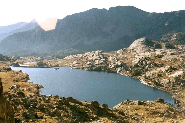
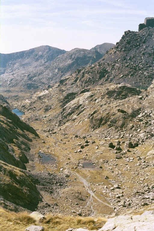
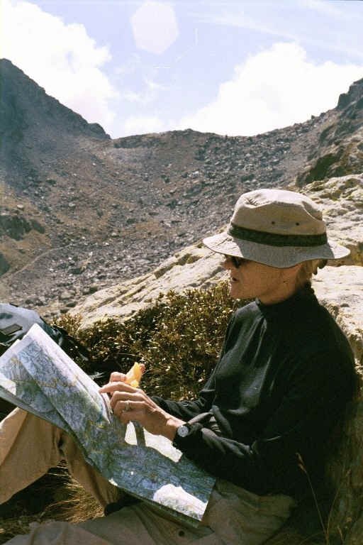
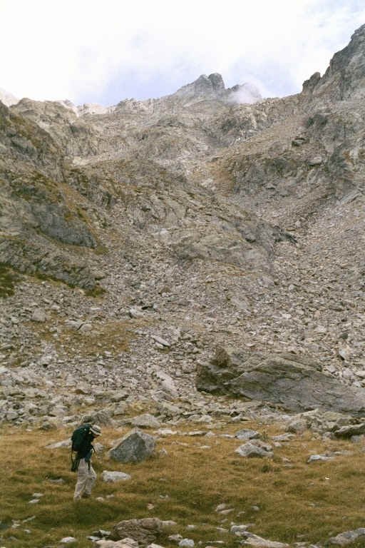
I awoke about 7:00 a.m. It was a unique bathroom experience with men and women sharing the sinks and the toilets which had long doors not quite reaching ceiling or floor. The petit dejeuner was the same bread as we had eaten the previous night with jam. The coffee was served in small bowls and it made us think of Emily and how she loved her coffee in bowls in Heidelberg. After breakfast and two bowls of hot-chocolate-enriched coffee, we folded up our blankets, packed up with three full water bottles and left the refuge about 8:10 a.m. It was cool and we kept on our fleece outer garments. Our trail went from the refuge to the Baisse de Valmasque, for which it was named. Early on we saw several of the prehistoric rock carvings for which the valley is famous. These were identified by signs pointing out their location. They were mostly inscribed on very flat rock surfaces and seemed to be carved by tapping a series of dots with another rock. The forms included arrowheads, deer heads, one of a chief and, further along the trail, one of a deer head that had been later converted into a head of Christ. There were black lakes with mountains rising on both sides of the trail and the obvious striations of a glacier that had moved through this gradually rising valley between the two rows of mountains. The trail climbed steeply zigzagging up to the Baisse de Valmasque, a high ridge between at the end of the valley. At the top there were views in all directions. To the west a bowl and lake surrounded by rocky mountains and to the east the valley we had hiked. There were a few people at the Baisse enjoying the view. After a rest we descended on the other side almost to Lac du Basto, then we veered left continuing on Grand Randonée 52 (to the Baisse de Basto) which climbed to the north over hillsides of rocks. We found a nice spot overlooking Lac du Basto for lunch about noon and, leaning back on rocks overlooking the lake, were again grateful for our peanuts, olives, crisp bread and oranges and wonderful sesame cookies which we had forgotten. After lunch we proceeded on across scree or jumbles of large rocks. We passed a lake and were getting low on water, but the lake was so low and stagnant that I didn't think it would be safe for water. So we went on to a very steep, steep climb to the Baisse de Basto. As we reached the top of the Baisse, another couple pointed out a large mother Bouquetin (a dark brown mountain goat with curved horns) and calf lying in the sun on a stone. They were difficult to spot, and almost impossible to locate with binoculars due to their camouflage. Another young attractive couple also arrived from the Refuge de Nice and we showed them the Bouquetin. They had large packs like ours (most people had smaller day packs) and he indicated that though the maps said it was two and one half hours from the refuge it had taken them three and a half. After a rest to admire the Bouquetin, we started down a precipitous drop into a rocky valley bowl. We couldn't imagine how Angela and Keith Hill had made it up! It was hard going and sometimes the loose gravel would shift under our feet. The couple we had first seen at the top preceded us by some distance and showed what a long way down it really was. We stopped at one point to watch three Bouquetin including a ram and a mother with a nursing calf. It was a long steep climb down and I managed to get blisters on both my big toes. At the bottom we had now run out of water. We located a stream about one hundred yards out of our way that was crystal clear. After pumping and quenching our thirst, we proceeded on through a valley as clouds began to cover the peaks and the Baisse behind us creating dramatic contrasts between the sun and the dark shadows. A mile or so further on we again we lost altitude dropping down quite quickly. There were dramatic cliffs on all sides and in front of us, and far down below we saw our destination, the Refuge de Nice. I spotted a Chamois - a deer or antelope like animal - on a slope and further down a small herd, which kept our attention as we descended to the refuge. We arrived a little after 4:30 p.m. and had probably hiked about 10 difficult miles. The woman who ran the refuge assigned us lits 53 and 54 on a bottom row of bunks in a small room on the second floor with about 16 bunks. We changed into warmer clothing (including long underwear), as it had gotten quite cold and windy. The refuge was located in the bottom of the V of the deep valley between two mountains. There were long waterfalls on several slopes nearby emptying down into streams which fed the Lac de la Fous (Lake of Fools) on the other side of the refuge. We had bowls of hot tea as we pored over a large map in the refuge. The trail at times was represented by a dotted line which I couldn't understand. One of the people there explained that this was where the trail went over scree or fallen rock and was only recognizable by rock cairns. Dinner followed at 7:00 p.m. The other six people at the table were all French and we were in the middle. (There were only 8 at the refuge that night, though there had been 30 the night before). Our companions were not very inclusive, but we had a delicious stew and noodle dinner, followed quickly by bed. |
|
|
|
Copyright 2001 Donald R. Chauncey - All rights reserved |


